As found on RHEA Group website - the senior partner in the spaceport consortium.
https://www.rheagroup.com/services-solutions/space/space-infrastructure/spaceports/
As found on RHEA Group website - the senior partner in the spaceport consortium.
https://www.rheagroup.com/services-solutions/space/space-infrastructure/spaceports/

Over 200 written objections have already been submitted to Comhairle nan Eilean Siar (Western Isles Council)
Should anyone still wish to submit an opinion the ‘competent body’ are required to consider all comments.
The Comhairle as Planning Authority will extend the public consultation period on the application/EIA Report to: MONDAY 21st MARCH 2022

“Given current developments in the Russian invasion of Ukraine, this is likely to significantly compromise not only CST themselves, in any operations in the UK, but also as a consequence CnES.”
Comhairle nan Eilean Siar (CnES - Western Isles Council) have withdrawn their original planning application Ref. No. 19/00311 for Phase1of Spaceport 1 (the first phase of an overall proposed 4 phase development).
This has been replaced by a new application 21/00646/PPD for a Sub-orbital Vertical Launch Spaceport Facility, submitted on 11th Feb 2022. This is in effect a refinement of the original Phase 1 application.
The Council have advised that all previous objections will not be carried forward, and that should anyone wish to make representations in respect of the new application they will need to do so by the 13th March 2022.
A request to extend the period for representations to be made has been submitted to CnES, but there is no certainty that this will be granted.
The follow-up Spaceport1 consultation meetings will take place as follows:
18 September, Carinish Hall
12 - 2pm
7 - 9pm
19 September, Carinish Hall
12 - 2pm
Please pass this e-mail on to anyone who may be interested in attending.

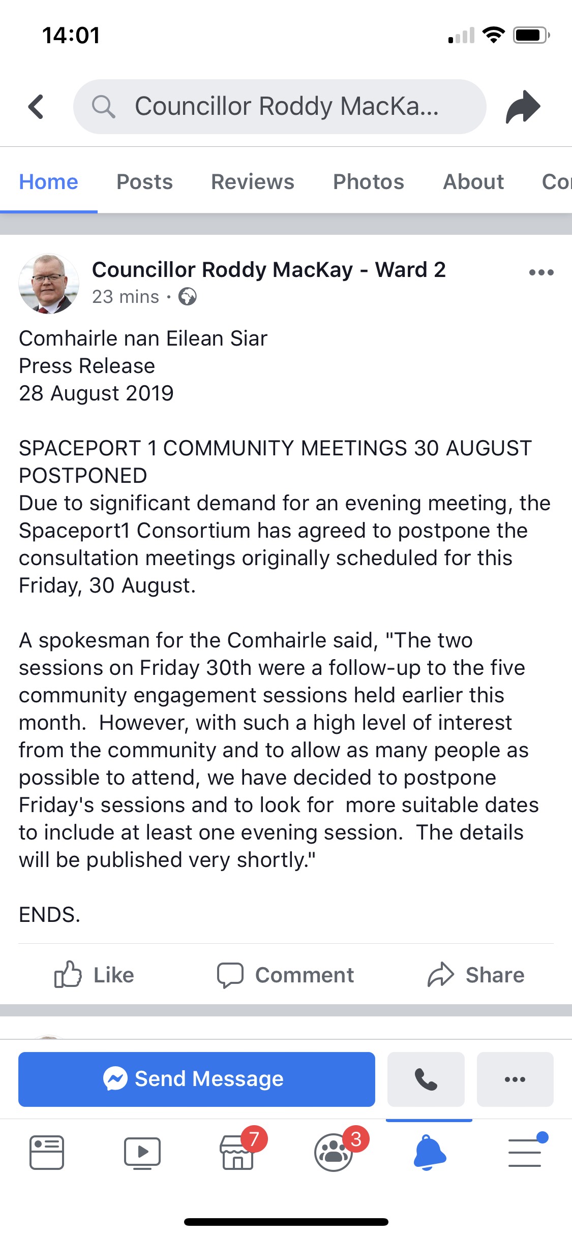
Comhairle nan Eilean Siar have announced that scheduled community meetings on 30th August have been postponed. “The two sessions on Friday 30th were a follow-up to the five community engagement sessions held earlier this month. However, with such a high level of interest from the community and to allow as many people as possible to attend, we have decided to postpone Friday’s session and to look for more suitable dates to include at least one evening session. The details will be published very shortly”
In line with our concerns about the threat to biodiversity loss at Scolpaig (should the proposed Spaceport 1 project reach fulfilment) Scotland’s First Minister Nicola Sturgeon has responded to Scottish Environment LINK’s call for her to to “protect, enhance and restore our environment”. You can read the First Minister’s response here.

Photo by Mark O’Clery
Much discussion has taken place about the south west boundary of the National Scenic Area (''NSA'') as it relates to Scolpaig. Maps produced for/ by Scottish Natural Heritage (''SNH'') are not consistent in defining the south west boundary of the NSA at Scolpaig, and the written description of the NSA as originally prepared by SNH is insufficiently detailed to be precise.
However, SNH Commissioned Report No.374 (refer below) gives specific details of the special qualities of the NSA and specifically references Scolpaig in the first of the extracts given below. This clearly indicates that the beach and headlands either side are included within the NSA and, therefore, virtually the whole of Scolpaig farm is to be considered as included in the NSA, as would be expected. This is as shown on the particular SNH map with the boundary overlain on the Ordnance Survey map (part copy below).
The photograph above is of the area of Scolpaig Farm not shown as included within the NSA on SNH's digital map, but shown as included within the NSA on SNH's Ordnance Survey based map, with the boundary overlain. On a clear day St. Kilda is visible on the horizon beyond the Haskeir Islands in the centre of the photograph. The photograph speaks for itself.
This is significant as it affects planning considerations. The other extracts also have a very particular resonance to Scolpaig:
“Scolpaig, on the western edge of the NSA is a good example of intertidal rock platforms flanking an outer bay, with a well-formed dune situated at the bay head - a form typical of North Uist’s coast”
“Westwards the expansiveness of the Atlantic Ocean is a constant reminder that this is the edge of Europe - reinforced by far distant St Kilda visible low on the horizon.”
“Throughout the isles, scenery and landscape is permeated by a sense of history. Human activity has left subtle, yet perceptible traces that give a strong sense of continuity and place.”
“Hebridean sounds add richly to the scene: the sound of the wind is a defining quality, and in coastal areas, the sound of waves is ever present - their loudness determined by the prevailing weather. The call of the birds is a summer sound of the machair. Natural sounds tend to predominate due to the absence of traffic and other man-made noise”
—- Extracts from: Scottish Natural Heritage (2010). The special qualities of the National Scenic Areas. SNH Commissioned Report No. 374.
(Site link - https://sitelink.nature.scot/site/9149)

Map of the Scolpaig region showing south west boundary of the National Scenic Area
The final consultation meetings relating to the Phase 1 planning application take place on Friday, 30th August, in Carinish Hall.
The meeting times are 10.00am to 12.00pm, and 1.00pm to 3.00pm.
CnES/ the Consortium are to be represented by Joe MacPhee, Alison MacCorquodale and Mark Roberts.
Their intention is to provide further information on some of the issues not covered in the original presentations, such as governance of the Spaceport and the Business Case. The format is to be as before with Q&A's following the presentations.